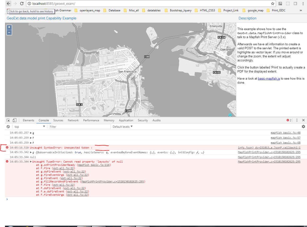
Неожиданный токен ошибки обратного вызова jsonp модуля печати Mapfish:
Я разрабатываю один модуль печати с геосерверной печатью, геоэкстерами и открытыми слоями. У меня есть код загрузки с сайта Geoext, и он отлично работает. Когда этот код настроен на локальной машине, он не работает. Выдает ошибку о неожиданном токене: при вызове функции обратного вызова jsonp. 
и мой код
Ext.require([
'GeoExt.component.Map',
'GeoExt.data.MapfishPrintProvider',
'GeoExt.data.serializer.TileWMS',
'GeoExt.data.serializer.Vector'
]);

  var olMap;
  var mapComponent;
  var mapPanel;

Ext.application({
name: 'MapPanel',
launch: function() {
    var description;

    var extentLayer = new ol.layer.Vector({
        source: new ol.source.Vector()
    });


    var bgLayer = new ol.layer.Tile({
        source: new ol.source.TileWMS({
            url: 'https://ows.terrestris.de/osm-gray/service',
            params: {
                LAYERS: 'OSM-WMS'
            }
        })
    });

    olMap = new ol.Map({
        layers:
        [
            bgLayer,
            extentLayer
        ],
        view: new ol.View({
            center: ol.proj.fromLonLat([-122.416667, 37.783333]),
            zoom: 12
        })
    });

    mapComponent = Ext.create('GeoExt.component.Map', {
        map: olMap
    });

    console.log(mapComponent);

    mapPanel = Ext.create('Ext.panel.Panel', {
        title: 'GeoExt.data.model.print.Capability Example',
        region: 'center',
        layout: 'fit',
        items: [mapComponent]
    });

    console.log(mapPanel);

    description = Ext.create('Ext.panel.Panel', {
        contentEl: 'description',
        title: 'Description',
        region: 'east',
        width: 300,
        border: false,
        bodyPadding: 5
    });

    console.log(description);

    /**
     * A small utility method that will change the `baseURL` from https to
     * http (if needed and possible), because the MapFish instance we are
     * talking to currently cannot handle all 'https' requests.
     *
     * Please note that this is a restriction posed by the remote server, a
     * correctly configured MapFish instance can very well handle https.
     *
     * @param {Array<Object>} layers An array of serialized layers.
     * @return {Array<Object>} An array of serialized layers, https URLs
     *     will now point to their http-equivalent.
     */
    var unHttpsLayers = function(layers) {
        var changed = [];
        Ext.each(layers, function(layer) {
            var clone = Ext.clone(layer);
            if (clone.baseURL && (/^https:/i).test(clone.baseURL)) {
                clone.baseURL = clone.baseURL.replace('https', 'http');
            }
            changed.push(clone);
        });
        return changed;
    };

    /**
     * Once the store is loaded, we can create the button with the
     * following assumptions:
     *
     *     * The button will print the first layout
     *     * The attributes used are the first of the above layout
     *     * We'll request the first dpi value of the suggested ones
     * @param {GeoExt.data.MapfishPrintProvider} provider The print
     *     provider.
     */
    var onPrintProviderReady = function(provider)
    {
        // this is the assumption: take the first layout and render an
        // appropriate extent on the map

        console.log(provider);
        var capabilities = provider.capabilityRec;

        console.log(capabilities);

        var layout = capabilities.layouts().getAt(0);
        console.log(layout);

        var attr = layout.attributes().getAt(0);
        console.log(attr);

        var clientInfo = attr.get('clientInfo');
        console.log(clientInfo);


        var render = GeoExt.data.MapfishPrintProvider.renderPrintExtent;
        console.log(render);

        render(mapComponent, extentLayer, clientInfo);
        mapComponent.getView().on('propertychange', function() {
            extentLayer.getSource().clear();
            render(mapComponent, extentLayer, clientInfo);
        });


        description.add({
            xtype: 'button',
            text: 'Print',
            handler: function()
            {
                var spec = {
                    layout: layout.get('name'),
                    attributes: {}
                };
                var firstFeature = extentLayer.getSource().getFeatures()[0]; console.log(firstFeature);
                var bbox = firstFeature.getGeometry().getExtent(); console.log(bbox);
                var util = GeoExt.data.MapfishPrintProvider; console.log(util);
                var mapView = mapComponent.getView(); console.log(mapView);
                var serializedLayers = util.getSerializedLayers(
                    mapComponent,
                    function(layer) {
                        // do not print the extent layer
                        var isExtentLayer = (extentLayer === layer);
                        return !isExtentLayer;
                    }
                );
                serializedLayers = unHttpsLayers(serializedLayers);
                serializedLayers.reverse();
                spec.attributes[attr.get('name')] = {
                    bbox: bbox,
                    dpi: clientInfo.dpiSuggestions[0],
                    layers: serializedLayers,
                    projection: mapView.getProjection().getCode(),
                    rotation: mapView.getRotation()
                };
                Ext.create('Ext.form.Panel', {
                    standardSubmit: true,
                    url: '/geoserver1/pdf/',
                    method: 'POST',
                    items: [
                        {
                            xtype: 'textfield',
                            name: 'spec',
                            value: Ext.encode(spec)
                        }
                    ]
                }).submit();
            }
        });
    };


    //http://localhost:8585/geoext_exam/test/data/PrintCapabilities.json
    Ext.create('GeoExt.data.MapfishPrintProvider', {
        //url: '/geoserver1/pdf/info.json',
        url:'/geoserver1/pdf/info.json',
        listeners: {
            ready: onPrintProviderReady
        }
    });

    Ext.create('Ext.Viewport', {
        layout: 'border',
        items: [
            mapPanel,
            description
        ]
    });

}
});
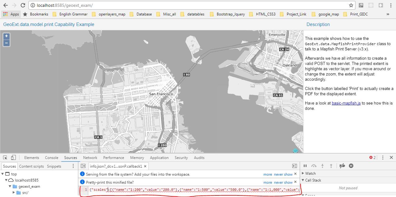
в этом коде я изменяю URL, который вызывается из геосервер (прокси), и это дает мне вывод в сети как 
Оригинальный рабочий пример geoext находится здесь
Но я не могу найти ошибку и как изменить этот код. Есть ли другое решение для этого.
Заранее спасибо.